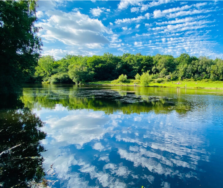
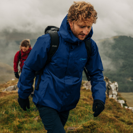
It’s a great time to get outside and enjoy the beauty that’s all around us. It’s also possible to enjoy a scenic hike through nature, and it may be closer to you than you think – even if you live in a city.
Venturing outdoors is a great way to soak up nature, and it’s also a great form of exercise. Now is the best time to get yourself out into the fresh air, so we’re here to help you find the ideal walking or hiking trail.
Winfield’s has picked out some of the best hiking and walking routes near various cities around the UK. Some of these will require some travel (but not much), while others are in the city boundaries themself, cutting out a car journey.
Read on to discover some of the best hiking and walking routes on the doorstep of these UK cities…
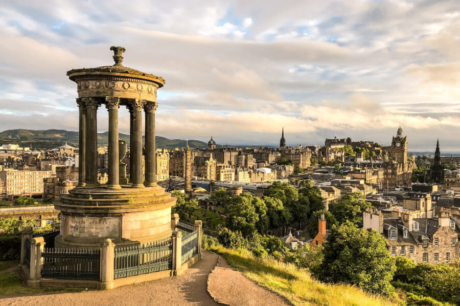
Seven Summits of Edinburgh
Edinburgh 17 miles 8 hours
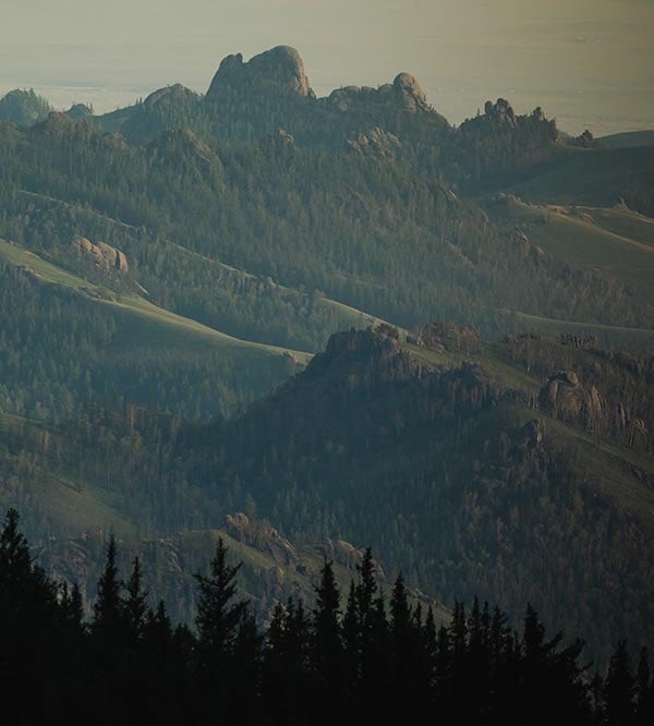
As the name says, this incredible hike is in the stunning Scottish capital, Edinburgh.
There’s such a wealth of beauty in Edinburgh, why not explore the city itself? The city was built on seven hills, and you’ll summit them all on this route. The entire way can cover 17 miles and you’ll have a fantastic tour of the city. The Seven Summits includes the biggest hills and best lookout points within Edinburgh, so you can truly appreciate this unique capital.
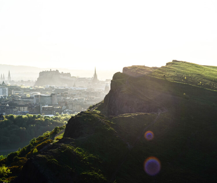
Most of this route is on streets, roads and footpaths, so you may not be as in-nature as other routes but you do have the chance to pop into a cafe or find cover if the weather changes. The trail starts on Calton Hill, right next to Princes Street, with a walk up to Edinburgh Castle, the first of the peaks. The highest point on the route is at 720 feet, Arthur’s Seat.
The extinct volcano is one of the highlights of the trail, and of Edinburgh, with amazing panoramic views. Arthur’s Seat back to Calton Hill isn’t far, which is the final stretch. The full route will take the bulk of your day and if you do complete it, you can absolutely claim you’ve seen the city. For easier walks, you can break this down into separate trails.
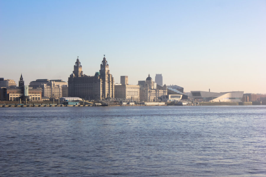
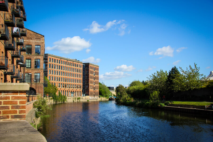
Wirral Way & Circular Trail
Liverpool 13 miles 5 hours
This route takes in almost the entire Wirral Peninsula on Merseyside as it hugs three coastlines.
Across the river from Liverpool, the stunning Wirral Way will provide you with views of the famous Liverpool waterfront, North Wales and across the Irish Sea to the Lancashire coast. Not only that, but you’ll see a varied amount of animal life in this part of the UK. Mostly flat, this is an extremely accessible route, ideal for families.
Most of this route is on streets or pavement, the majority of the route facing Liverpool is on a promenade. However, further around the trail, and depending on the tide, you could walk along many of the beaches on the Wirral. The Wirral Way “starts” at Seacombe Ferry, but you could easily start back in Eastham or Port Sunlight or further around the coast.
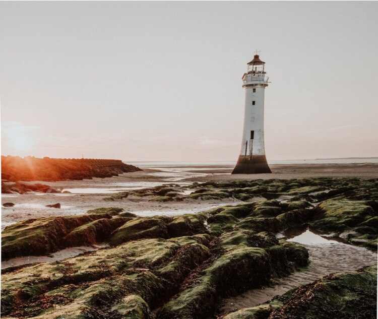
The route takes all the way around Wirral, through New Brighton, West Kirby and Wirral Country Park, where the Wirral Way ends. You could, however, extend your walk down to Parkgate or to Willaston as part of the Wirral Circular Trail. You can also add on a trip across to Hilbre Island at West Kirby but always check the tide.
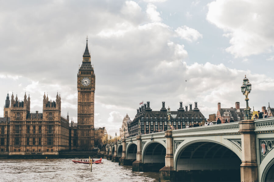
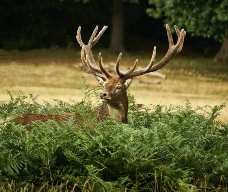
Richmond Hill Loop
London 12 – 18 miles 5 – 7 hours
There are two choices you have for the Richmond Hill Loop, both of which include summiting Richmond Hill and great views across London.
You can start this route in either Northfields – for a longer trail – or Chiswick with both being extremely rewarding with views of central London, Richmond Park, deer, Terrace Gardens and Beverley Brook. The highest point of either trail is 575 feet, Richmond Hill itself, so the route isn’t too strenuous with much of it on pavement.
With most of the route on pavements, you’ll be able to duck under cover or grab a drink on your way round. While you may not be as in-nature as you may like, this is London where hiking routes are harder to come by, but the second part of the trail is extremely rewarding. By this, we mean you’ll be able to take in the former royal deer park in Richmond.
The Loop takes in plenty of landmarks and beautiful areas of the capital, including Kew, Gunnersbury Park, Richmond itself, Syon Park and the shores of the Thames. You can make changes to this walk, because it covers a lot of area, to include Twickenham, Kingston, Wimbledon and much more or even to scale it back.
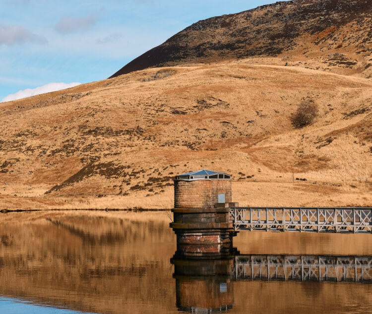
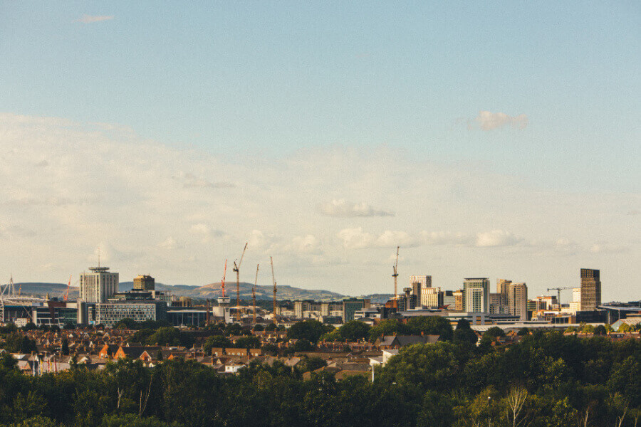
Dovestone Reservoir Loop
Greater Manchester Up to 10 miles Up to 5 hours
Manchester has the Peak District not too far away, but it also has the beautiful Lancashire countryside – and this route has plenty of choices for a hike.
You can start at any of the car parks near the reservoir, and then you have a number of trials available. You can simply walk around the edge of the reservoir or head into the hills and explore the stunning rock formations for incredible views of Greenfield and Greater Manchester. The highest point is over 1,000 feet with a number of viewpoints.
There is a mixture of pathways on the route, so walking boots are advised and you should consider the weather that has been around a few days before heading on your hike. This may affect the ground you’ll be walking on. Part of this trail is rocky, but the reward is incredible views across the reservoir from numerous rocks outcrops.
The route comes back down to join the edge of the reservoir for flatter ground where you can ease your muscles before heading back into Greenfield or for your journey home. The reservoir has a variety of hiking and walking routes, so you can pick and choose depending on the time of year, weather and when you’ll start.
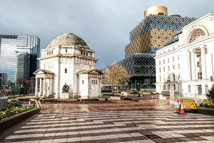
Sutton Park Loop
Birmingham Up to 8 miles Up to 4 hours
When you have one of the largest public parks in Europe on your doorstep, why not explore all or it – that’s what this route offers.
The beauty of this trail, besides the park itself, are the number of routes available and that you won’t be going over any rough ground – there are flat paths. This means that your family can enjoy this walk or hike without worrying about trips and falls on uneven terrain. You can explore the nature reserve, wetlands, lakes, and extensive ancient woodlands.
The majority of the trail is on paths, making this flat and sure underfoot, but there’s no reason why you can’t always cut across parts of the park. There’s also little by way of elevation change, making this an accessible route and ideal for simply getting out and about at any time of year. If the weather does turn, there are plenty of places to take cover.
There is no definitive starting point for the route (it is a park after all) so you can make your own trail that takes in the popular spots, including the various pools and animal sanctuaries. There is an official walking route that is 5 kilometres, but by being creative, you can walk around the lakes and heathland that make up the park.
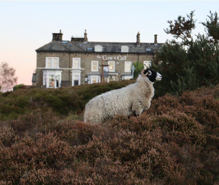
Dales Way Link
Leeds 15 – 20 miles Up to 8 hours
If you looked up the full Dales Way, it would no doubt sound like an amazing challenge – from Yorkshire, all the way to Windermere. This is just a small but stunning section.
This hiking trail starts in the heart of Leeds at Woodhouse Moor and takes you to Ilkley. Along the way are some incredible landmarks, including Adel Woods, Eccup Reservoir, Bramhope, Caley Deer Park, and much more. The highest point is over 1,000 feet with the trail – a mix of pavement, pathway and climbs up hills – a good challenge along the route.
On this trail, you can take in the views from Otley Chevin and the stunning natural landscape of The Cow and Calf, all in one day. And that just scratches the surface of “God’s Own Country”. Part of this route is easy with it starting in the city centre but you’ll have to dig deep to complete the whole route, with challenging hills and paths.
Ilkley is the “official” starting point of the Dales Way, but Leeds is one of three southern extensions, including Bradford and Harrogate. There are various routes to take out of the city centre but you’ll eventually be in the beautiful rural countryside to the north of Leeds. You could even follow the Leeds – Liverpool canal before heading on to Ilkley Moor.
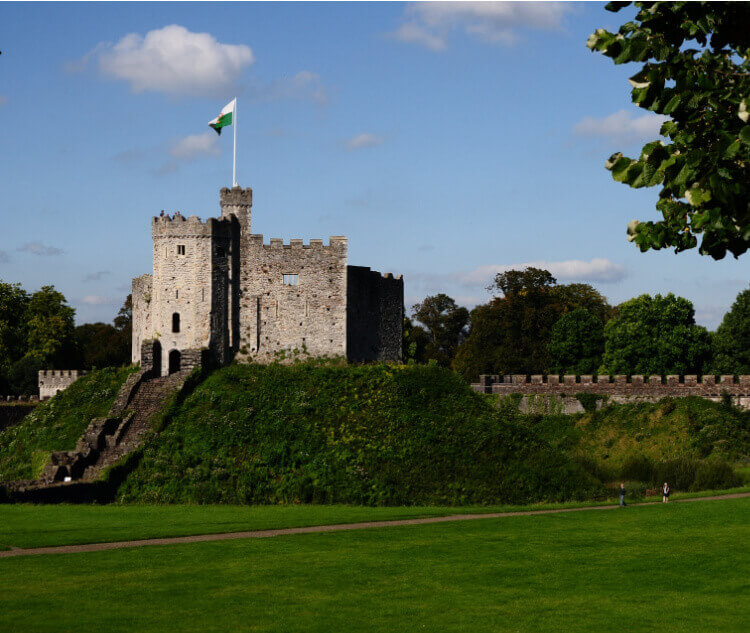
Caerphilly Mountain
Cardiff Up to 15 miles Up to 5 hours
This route is in two parts and includes Cardiff’s public parks before rewarding you with incredible views from the summit following a long walk.
This hiking or walking trail is in two parts – it starts in the city centre of Cardiff before a circular loop around the mountain. Therefore, you get to see incredible sights, including the public parks and castle in Cardiff, before views of Caerphilly and across the capital to the Bristol channel. The highest point you’ll get to is 889 feet at the summit.
This route allows you to be quite creative when leaving Cardiff – you could head up towards Thornhill or go via the enchanting Castell Coch. The latter actually forms part of the incredible Cambrian Way, a 270-mile trail that runs up the spine of Wales from Cardiff to Conwy. So, at least going this way, you can say you’ve done the Cambrian Way.
Most of this route is on pavement and pathways, so it should be sure underfoot with the only potential area for mud being as make your way around the mountain. This is a trail that offers the perfect mix of countryside, for views and being among nature, as well as the city, should the weather turn or you fancy a warm drink on your way back down the route.
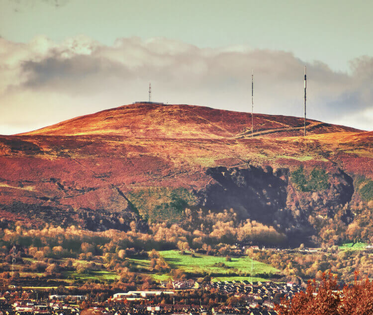
Divis Ridge Trail
Belfast Up to 12 miles Up to 5 hours
This route takes in the highest of Belfast’s hills and rewards you with stunning views following a long walk from the city centre.
This walking route is broken into two parts – the first part starts in the centre of Belfast before the trail around the Divis and Black Mountain. So, you’ll get to enjoy the highlights of the city, including St Anne’s Cathedral and the Peace Wall before heading upwards. The highest point you’ll reach is 1,568 feet at the summit of the Divis.
You can be creative with your trail, of course, by the route you take out of Belfast. You could go through Whiterock Grove and Hannahstown or past Clarendon Park. Of course, you could just do the trail and drive or get the bus and then set off on foot. This is an accessible trail once on the hills, made up of pathways and boardwalks.
Once on the trail, you have an incredible opportunity to enjoy 180-degree views across the city and further afield. You’ll be able to spot the Antrim Plateau to the north, Scotland to the east and Mourne Mountains to the south. There’s nowhere else in Belfast that can offer this and a brilliant walk among nature, including purple heather in autumn.
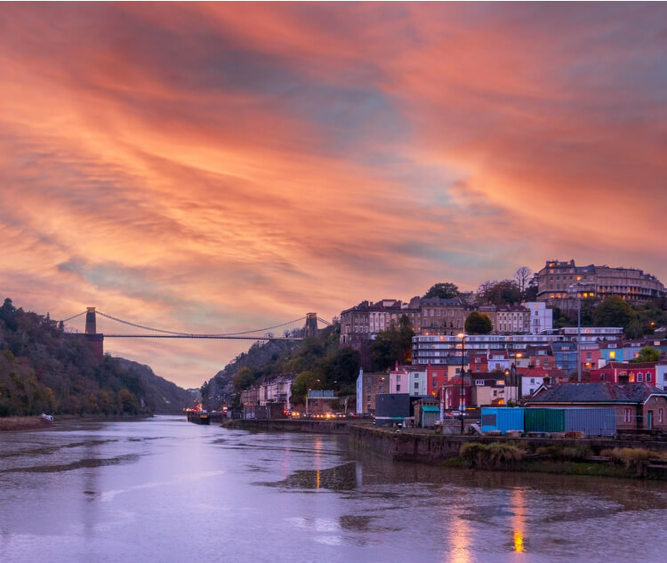
Leigh Wood Loop
Bristol Up to 8 miles Up to 4 hours
This route combines the history, nature and engineering prowess of Bristol into one beautiful walk from the city centre to a nature reserve.
Like many of the walks and hikes, this is in two parts – the start in the heart of the city before heading into the Leigh Wood Nature Reserve and along the River Avon. This way, you’ll see the sights of Bristol, the Clifton Suspension Bridge and the old city, depending on where you start or finish. This is an easy walk with around 300 feet the highest point.
You can be quite creative with where you start and end your walk in Bristol. You could start in the Old City, on Spike Island – which you’ll have to cross anyway, Castle Park, anywhere you want. This is an accessible route that’s mostly on pavements and woodland pathways, so it will also be easier on joints and less strenuous, meaning your whole family can enjoy it.
On the trail, you’ll have plenty of different vantage points of the suspension bridge and be able to enjoy the beauty of Leigh Wood. Stockleigh Camp, Nightingale Valley and the Arboretum are just some of the sights. Continue beyond the park and Leigh Court to link up with the River Avon Trail to head back into Bristol alongside the serene river.
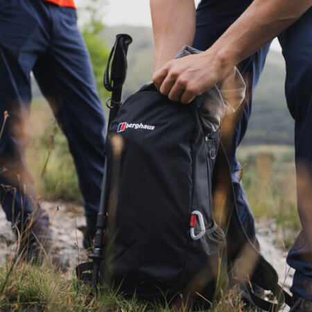
DON’T FORGET TO CHECK OUT OUR FULL OUTDOOR EQUIPMENT RANGE.
Boxing Day, for many, is a time for relaxing after a hectic Christmas the day before. One of the best ways to achieve that is enjoying some fresh air on a walk. We’ve picked out some of the best routes and destinations from around the UK for you to enjoy.
From wind-scoured wildernesses to shimmering lochs, and from picture-perfect seascapes to magnificent mountain ranges, we in the UK are truly spoiled for choice when it comes to deciding upon a beautiful landscape in which to hike. With Christmas and the New Year a distant memory by now, your thoughts might be turning to your first […]
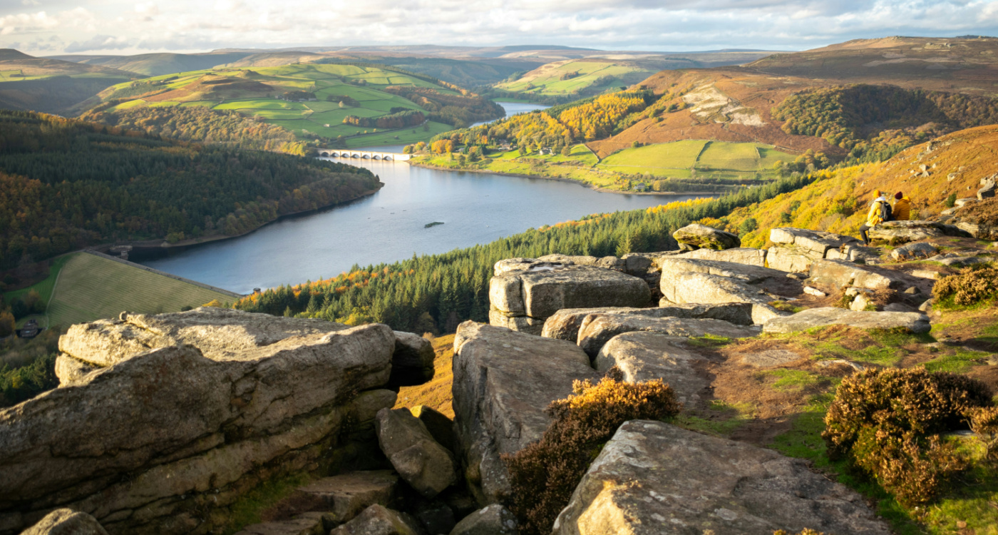
If you’re making it your mission to explore more of the UK, have you considered camping in the Peak District? This national park spans several counties, and has dozens of fantastic attractions, walking trails, and more! Learn more about the area with Winfields Outdoors.